
 Perth Lancelin


If you look at this diagram you will see that most of Lancelin’s dunes are the subject of mining tenements (green outline).
Even the off-road area which is administered by the Shire is included. BUT, it is unlikely that the off-road area would ever be mined as it would take all stake holders, shire, residents etc. to agree to it and there is no appetite for that.
So what is the sand used for? Farming. Farmers use it to neutralise acid in the soil. At present there is mining at the very southern end of the dunes well away from the off road area.
But there is a small area (top left green rectangle) which has been mined by a local farmer over the past years. This area is just north of the main sand boarding hill. 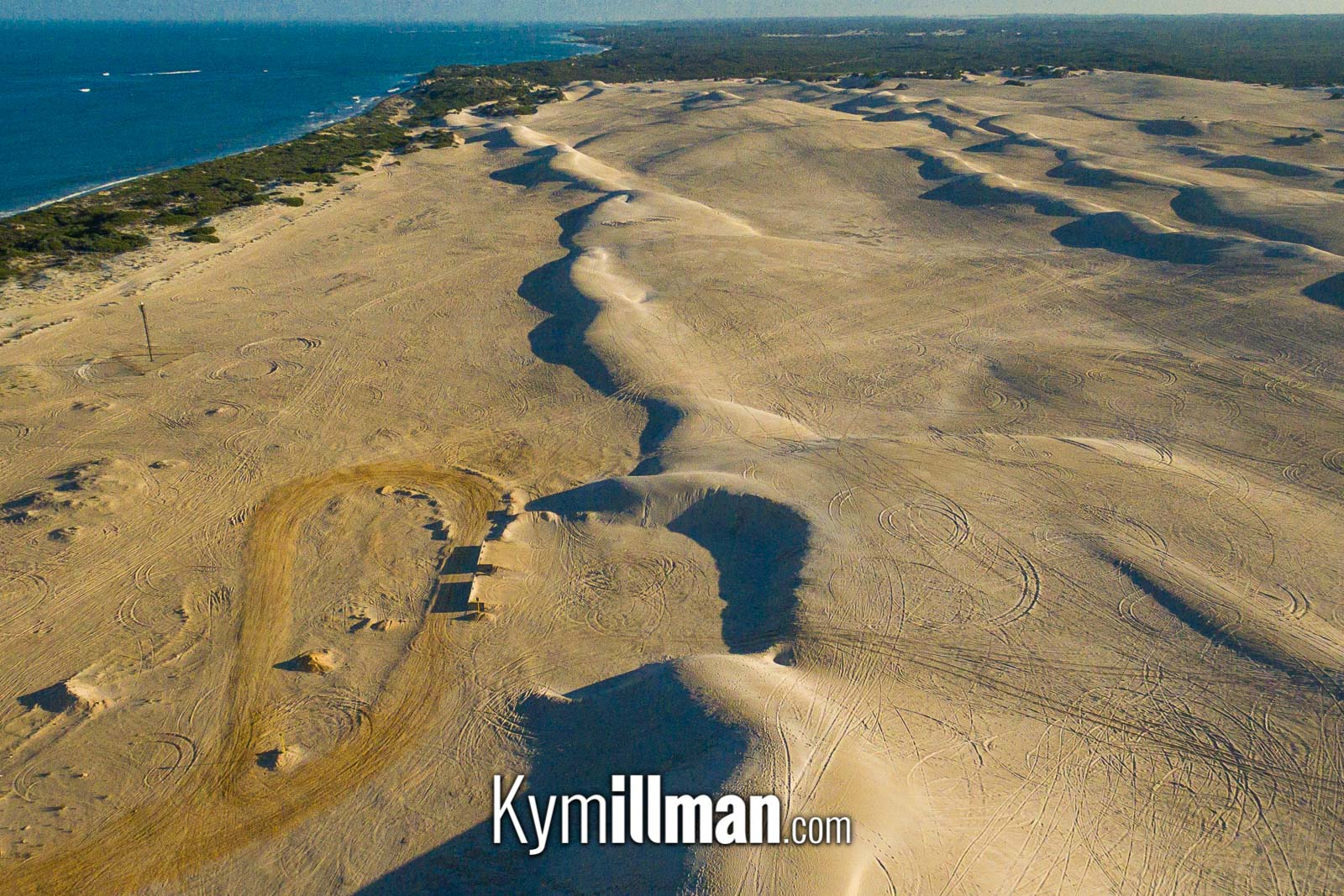 The above image shows where the sand was taken from a couple of years ago but more recently the mining was moved slightly north of the lead lights (below).
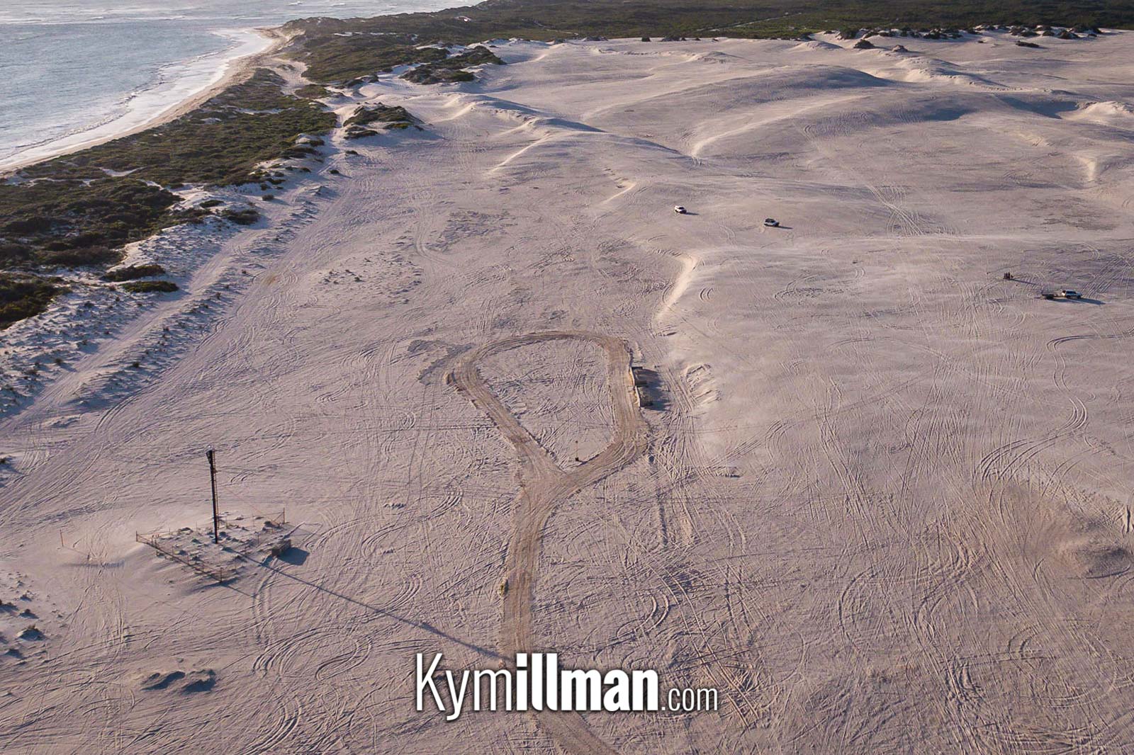
The above image shows where the sand was taken from a couple of years ago but more recently the mining was moved slightly north of the lead lights (below).It’s believed the farmer was told to stop mining recently due to safety concerns which makes sense given there are families on foot and in vehicles within metres of the trucks sometimes.
The red area on the map is subject to Water Corp restrictions, i.e. you are not permitted there as the town draws its drinking water from the water table below.
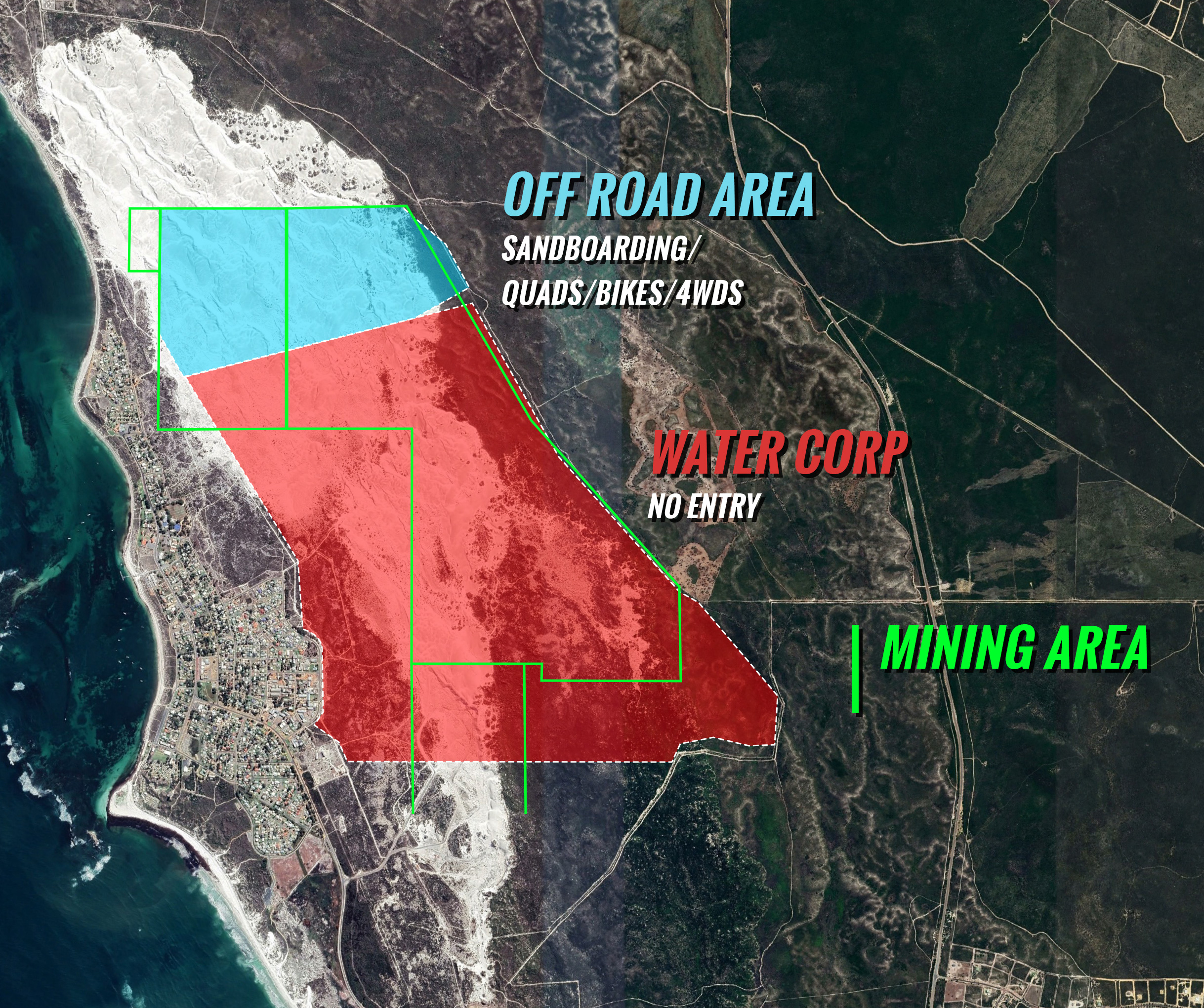
And lastly, the dune area at the top of the main pic is actually privately owned land that is technically off limits.
So there you have it, Lancelin’s dunes area explained.